Annotations from the Archives: A Map of the World
"Will the maps be back in the new exhibit?"
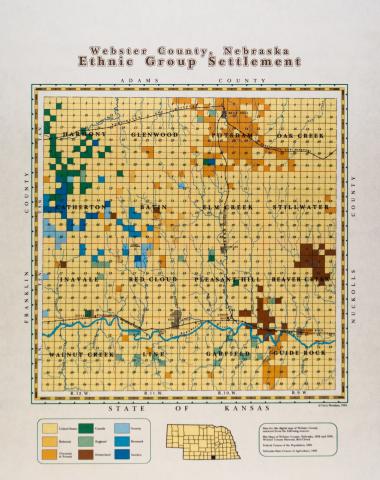
It's a question that we've all grown used to hearing, ever since we removed the peeling, sun-damaged interpretive panels and photos from the Burlington Depot walls as we prepared for the building's renovation. Easily one of the most popular features of our old Depot tour, several maps highlighted Webster County's immigrant population throughout the county. When we began to create the narrative for the new interpretive plan at the depot, our intention was to bring those maps back in their original form.
But it was also true that the maps were thirty years old, and incredible amounts of information were now available online through both paid and free services, like Newspapers.com, ChroniclingAmerica.gov, Ancestry.com, FamilySearch.org, and the National Archives, Archives.gov. We made use of all of these resources as we began to reevaluate the data that we would utilize in the depot.
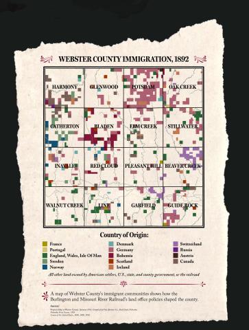
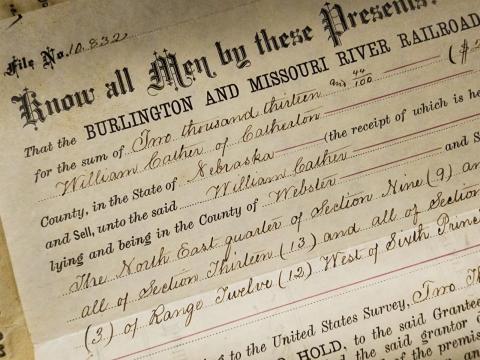
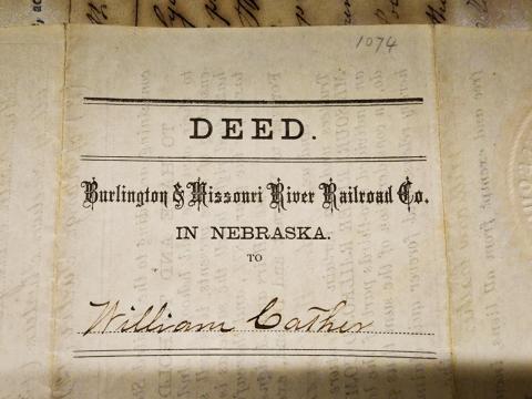
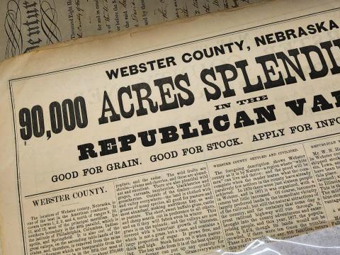
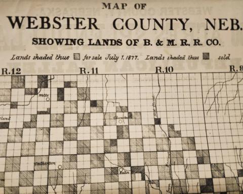
We felt an important change was to restrict our data to a single source map. While the previous immigration maps utilized plats from both 1892 and 1900, our narrative drew on the history of the Burlington & Missouri River Railroad (naturally) and told the story of the Burlington's efforts to recruit settlers to Webster County—both American settlers from the East and foreign-born people who hoped to settle in Nebraska. The B&MR heavily recruited in Europe throughout the 1870s and 1880s, so we utilized the 1892 plat map—the earliest one in our collection that contained land owner names—in an effort to best reflect railroad recruitment results.
From the very first, archivist Tracy Tucker knew that the map project would have parallel tasks: while Tucker researched every one of the 1,600-plus landowners on the list, the map itself needed to be recreated digitally for large format reproduction. Fortunately, she knew just the person: her husband, Terry Tucker, who studied and now teaches geographic information systems. During his work with the map images, Terry digitally layered the historic data over modern geographic data, then created an additional layer to subdivide the land by owner, and yet another to add demographic data—in this case, country of origin—as Tracy discovered it. Because the focus of the map was on immigration, little more was added beyond precinct names and borders, rivers, and streams.
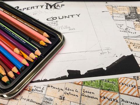
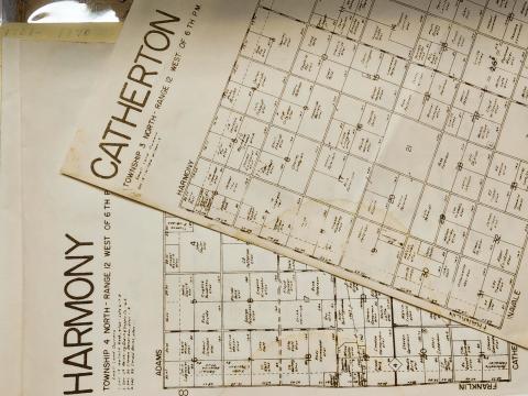
The research into each land owner looked different from the creation of the actual map: while the research sources were all online, the output was strictly analog. Part of the reason was practical: it is entirely possible to transfer all the information to a spreadsheet in another browser tab, but it's tedious and time consuming. It also seemed, Tracy Tucker said, more fitting somehow, to be coloring in the boxes. "I always think of archival work as both an art and a science," she said. "There are the facts that you see and document, and then there's the sense of understanding that you get when you surround yourself with the facts, when you just sit with things." That understanding, she said, both strengthens and complicates the map as an intellectual product.
"The thesis of the work," she said," was to see if I could verify and demonstrate the effectiveness of the Burlington's recruitment campaigns." Until the very end, she said, she was unsure if the map would show the same things that Sheahan's 1994 map showed, or if it would tell a different story. Researching precinct by precinct, Tucker said she had misgivings at times. In the end, the map did show several distinct immigrant communities, particularly groups from Canada, Germany, and Bohemia. Overall, however, the county's immigrant population seems dispersed across the precincts, with perhaps only one or two neighbors who were countrymen, rather than large blocks of settlers.
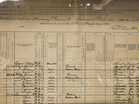
This data is derived from digitized federal census records and the Nebraska state census of 1885. (The best source for our purposes, the 1890 federal census, was lost in a 1921 fire in Washington, D.C. More than 99% of the population census records were lost in that disaster.) Census data of the time asked for both the respondent's country of birth and the respondent's parents' country of birth. Because our 1892 plat map falls between available census data, Tucker sometimes had to utilize several years of census records, as well as obituary, marriage, and family tree data to verify the country of birth.
This also brings up a shortcoming of the newly developed map. Some couples, Tucker noted, were born in different countries. How could a single map adequately represent those split households and still be legible? Should landowners who had large families and were all foreign-born be somehow represented differently than a man and a woman without a family? A weighted distribution of the population would show those details but would come at the expense of readability. With fourteen nationalities already competing for visual attention on the Webster County map, Tucker decided to keep the map simple: the printed map only represents the birth country of the person listed as owner on the 1892 plat map.
There are also gaps: men and women who just couldn't be located in local newspapers, census data, or other records. Some might be land speculators, like John G. Deshler, who appeared over and over again on the plat maps and the real estate transfer section of the Red Cloud newspapers. In hopes of verifying that he was a speculator and not a settler, Tucker eventually turned to Google, which quickly turned up the Ohio financier and real estate developer. Similarly, C.E. Perkins frequently appeared in the maps, but rather than land speculation, railroads were his business. Listed on real estate transfer records as trustee, Charles Elliott Perkins was the president of the railroad and acting as owner on the company's behalf.
So will the maps be back? Yes and no. We'll have a map, and it will show similar information about immigrant communities. The data is more granular, even as we are upfront about the shortcomings of any visual representation. And Tucker's hand-colored paper map, still evolving as new information is uncovered, will be there too.
We hope you will join us at the launch of our new exhibit in the Burlington Depot at this year's Spring Conference!
Sources used in the creation of the new map include:
- The Blanche Cather Ray Collection, particularly George Cather's 1880 census data and the Burlington advertising map of Webster County.
- U.S. Federal Census data from the National Archives and Records Administration, provided through Ancestry.com. Census data was consulted from the years 1880, 1900, 1910, and 1920 to account for inconsistencies of recorded names.
- Nebraska State Census data from the National Archives and Records Administration, provided through FamilySearch.org. This 1885 semi-decennial census becomes crucial for Nebraska land ownership research thanks to the fire that destroyed the 1890 federal census. You can learn about the history of this unusual census here.
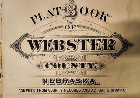
- Plat maps from 1880, 1892, 1900, and 1923, in the WCPM Collection. The 1892 map, compiled by Fort Abstract Company formed the basis of our mapping project. Other maps were consulted to verify family name spellings and variations and, at times, to try to establish country of origin through the census records of descendants who might have inherited the land.
- Newspaper records and FindAGrave.com for obituary data and news items mentioning land owners. This was particularly useful in the few cases where a landowner did not remain in Nebraska (or live long enough!) to be counted in a decennial census. In that case, their survivor's census record might be used to document a parent's country of birth. Red Cloud newspapers are available for free on several outlets, and the paid version of Newspapers.com now has nearly all of Webster County's papers digitized.